Area 2
-

- Anomaly in area 2 in the geomagnetical image
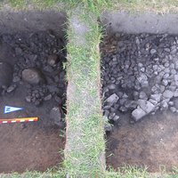
Area 2 was established to examine an anomaly of 3 m in diameter which was seen in the geomagnetical images (see image to the right). One half of a big roundish pit with a diameter of 2,8 m, whose upper parts were filled with numerous small and some bigger stones, was excavated. The density of stones decreased in a deeper level while the pit’s shape came out more and more clearly and took a rectangular shape in a depth of –80 cm.
-
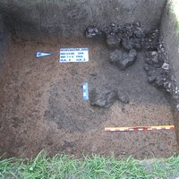
- One half of the excavated pit with stones and finds
- Shape of the pit in a depth of -80cm


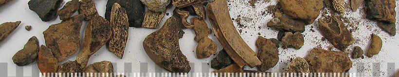
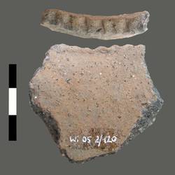
In the humus and very dark soil a lot of animal bones with traces of cutting and pottery sherds were discovered, which can be dated to the 10th to 12th cent. A.D. (Fig. 2).
-
- Ceramic
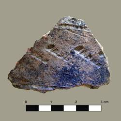
- Ceramic
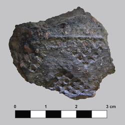
- Ceramic
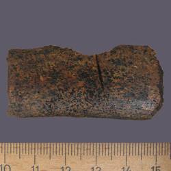
- Bone with traces of cutting
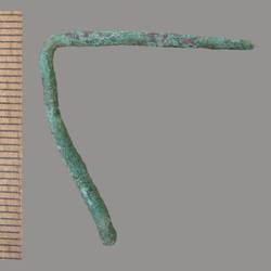
- Bronze needle
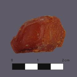
- Fragment of amber
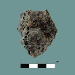
- Slag
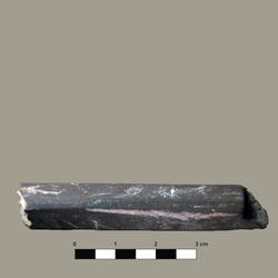
- Whetstone


Also two knives, slag, pieces of amber and a bronze needle were found. Through drillings the depth of the object was proven to be 1,5 m under field level, while the bottom of the pit seemed to be lined with more stones.
Only one half of the object was excavated, the rest will be examined in the year 2006. It is highly presumed that it belongs to the settlement, even though its function cannot be ascertained before the excavation is completed. For the time being the object can be interpreted as a pit house which was filled with waste material after its usage.
[top]