Results 2005
-
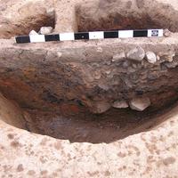
- Partly excavated oven

The analysis of the aerial pictures originating from the 1960s by Prof. V.I. Kulakov (Institute of Archaeology of the Russian Academy of Sciences Moscow) gave a number of clues that traces of the settlement could be south of the graveyard. The work in 2005 concentrated on the verification of these clues.
Dr. H. Stümpel and his assistants Dr. S. Wölz and H. Petersen from the Institute of Geosciences of the CAU Kiel carried out geomagnetical measurements with the use of a “Fluxgate-Dr. Förster” system on an area of 18 ha. They concentrated mostly in the south and west of the graveyard and on an narrow stripe in the north-west, close to the little river Woj.
The pictures show a loose arrangement of several anomalies with a diameter between 2-3m. Their number can be approximated to at least 200 objects, although only the bigger ones with diameters of more than 80 cm are taken into account.
With the use of a geological drill (the so called “Pürckhauer”) 80 anomalies were investigated. Accordingly, they were divided into three groups, in the course of which one substitute of each category was examined in an archaeological test trench.
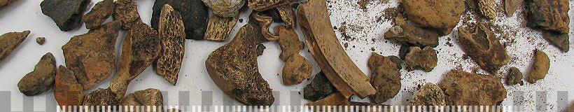
Area 1 uncovered an object with a layer of burnt clay (glossary: Under the influence of fire water withdraws from the clay, resulting in a hardened reddish layer of burnt clay.)
The geomagnetical images in area 2 uncovered an object of approx. 3 m in diameter, which exposed a pit filled with settlement waste material.
The third test trench (area 3) was arranged on the shore of a little river, in which the images revealed several bigger anomalies. A black earthed occupation layer of 20-40cm appeared.
The results of the campagne in 2005 recognised a greater settlement activity in the surrounding of the graveyard, whose size can only be ascertained by following geomagnetical measurements, which are planned for the campagne in 2006. At the same time a new excavation shall narrow down the settlements character.
Several stray finds of weights and silver coins in the immediate neighbourhood of the measured areas confirm the suspicion that the settlement of Wiskiauten could have been a trading point of supra-regional importance in the Viking Age, whose economical background surely lies in the rich amber deposits of the region.
[top]