The project
In the midst of the richest amber reservoir – the Sambian peninsula – on the territory of the early medieval culture of the Prussians, who lived here from the 9th to the 12th cent. A.D., lies an exceptional archaeological monument, the Viking Age cemetery of Wiskiauten.
The Prussians buried their deceased in big flatgrave cremation cemeteries. Only in Wiskiauten – as the only early medieval archaeological monument of the whole region – a graveyard is situated with over 500 burial mounds, telling us about a foreign influence at this site.
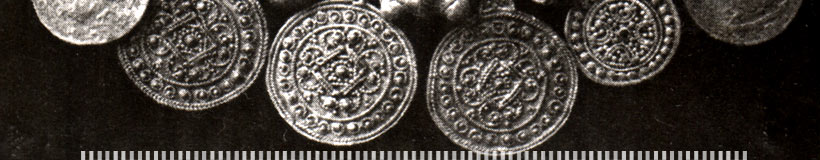
The find material, dated to the 9th-11th cent. A.D., is not typically prussian and seems to consist mainly of Scandinavian products.
Shortly after the first excavations of the year 1865, German archaeologists assumed that the mounds were the remains of Vikings from mid-Sweden, Gotland or Denmark. This opinion is generally accepted today, although recent theories speak of a polyethnical settlement, in which Scandinavians formed only one part.
Nevertheless, the cemetery documents the presence of Scandinavian settlers, merchants and warriors for at least nearly 200 years.
The supposed settlement, which must have been build shortly after the end of the settlement of Grobina 200 km north of Wiskiauten (a direct connection is possible), fits perfectly into the Viking Age trading network around the Baltic sea. It can be compared rudimentary with early towns like Haithabu, Birka, Kaupang, Reric/Groß Strömkendorf, Menzlin, Wolin, Ralswiek or Truso, in which the scandinavian population played a very important role.
The economical reason for establishing a Viking port of trade on the Sambian peninsula must lie in the rich amber deposits, which were the basis of development for the whole region at all times.
Whereas the Sambian peninsula is mentioned in some historical sources, the settlement of Wiskiauten itself cannot be linked to any name in written documents.
Where is the settlement ?
Although the graveyard has been under investigation in its approximate character, archaeologists could not find any definite evidence for the location of the settlement in nearly 120 years. This changed in 1979, as the Russian archaeologist V.I. Kulakov presented his first ideas about the settlement. He is of the opinion that the settlement is partly covered by the cemetery (Kulakov 2005). Two uncovered stone settings were interpreted as ground plans. He additionally analysed an aerial photo, which led to his suggestion that settlement structures must be expected in the surrounding of the graveyard (Kulakov 1994, 82 Fig. 39).
Questions about the exact location of the settlement, its extension, character and inner structure are not satisfactorily answered by the two aforementioned excavations.
For this reason the area with the potential settlement of a size of about 2 km2 has been under renewed examination since 2005. The Russian-German co-operation uses methods from natural sciences, such as geophysics.
[top]